
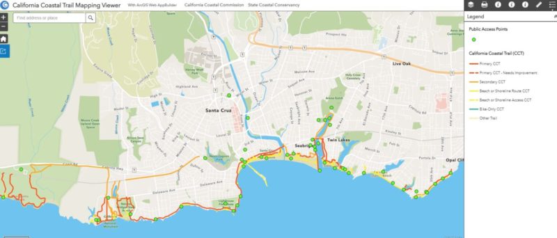
SAN FRANCISCO _ The Coastal Commission and Coastal Conservancy released a digital map that for the first time shows the existing sections of the California Coastal Trail, a three-year project that will be critical to completing the rest of the trail.
“What a milestone,” said Coastal Commission Executive Director Jack Ainsworth. “There are currently 875 miles of trail and now we can finally see exactly where they are, so we can eventually bridge those gaps and finish the trail.”
The California Coastal Trail, which has been in the planning since 1975, is a network of trails that will eventually allow the public to traverse the length of California’s 1,230-mile-long coast. The varied trail is not a single pathway but a collection of parallel threads and is about 70 percent complete. The trail takes participants through beaches, along blufftops and hillsides, on footpaths, sidewalks and separated bicycle paths maximizing scenic coastal views. Portions of the trail are accessible on foot, bicycle, wheelchair users and on horsebacks as well.
“The California Coastal Trail is one of the only flagship trails in the country that is accessible to almost everyone,” said Coastal Conservancy Executive Officer Sam Schuchat. “Many Californians have walked a segment or two without even realizing it! With this map, people can find trail segments easily, as well as public access points to get to the shore.”
Read More…